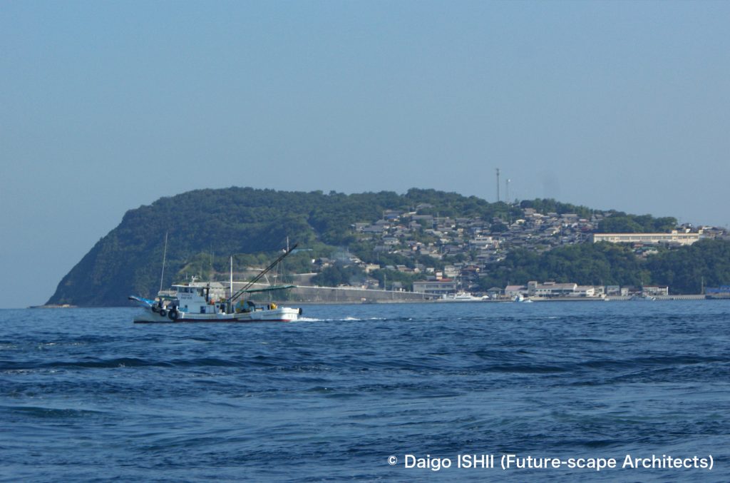
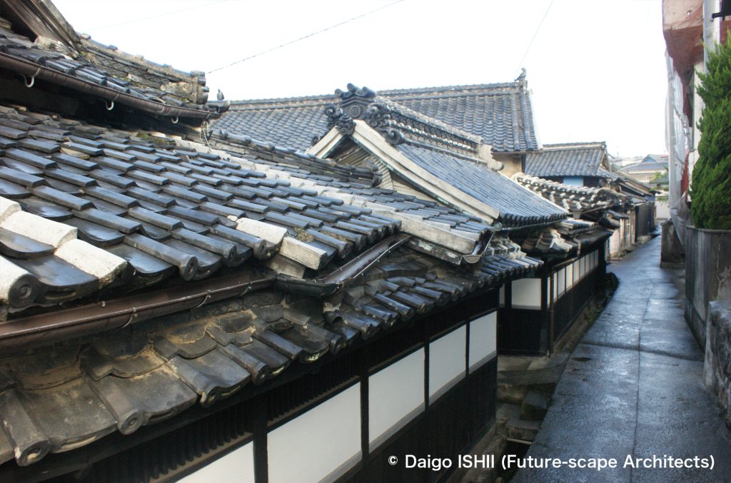
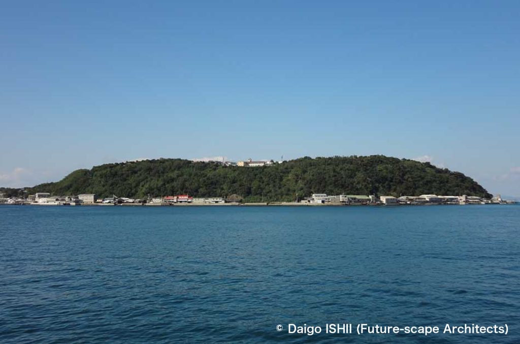
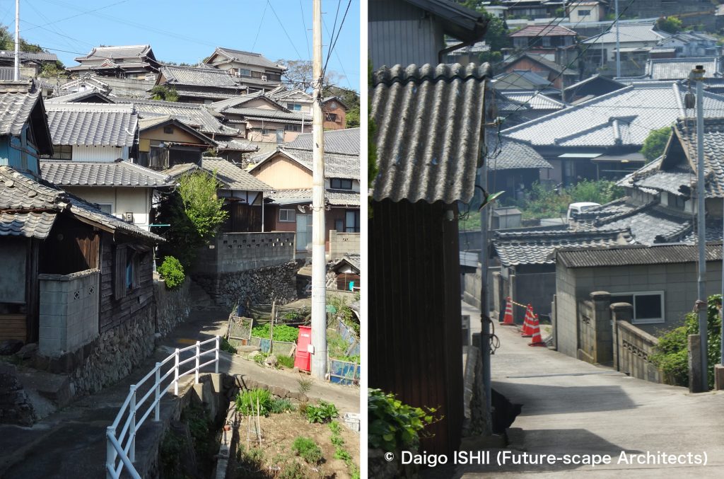
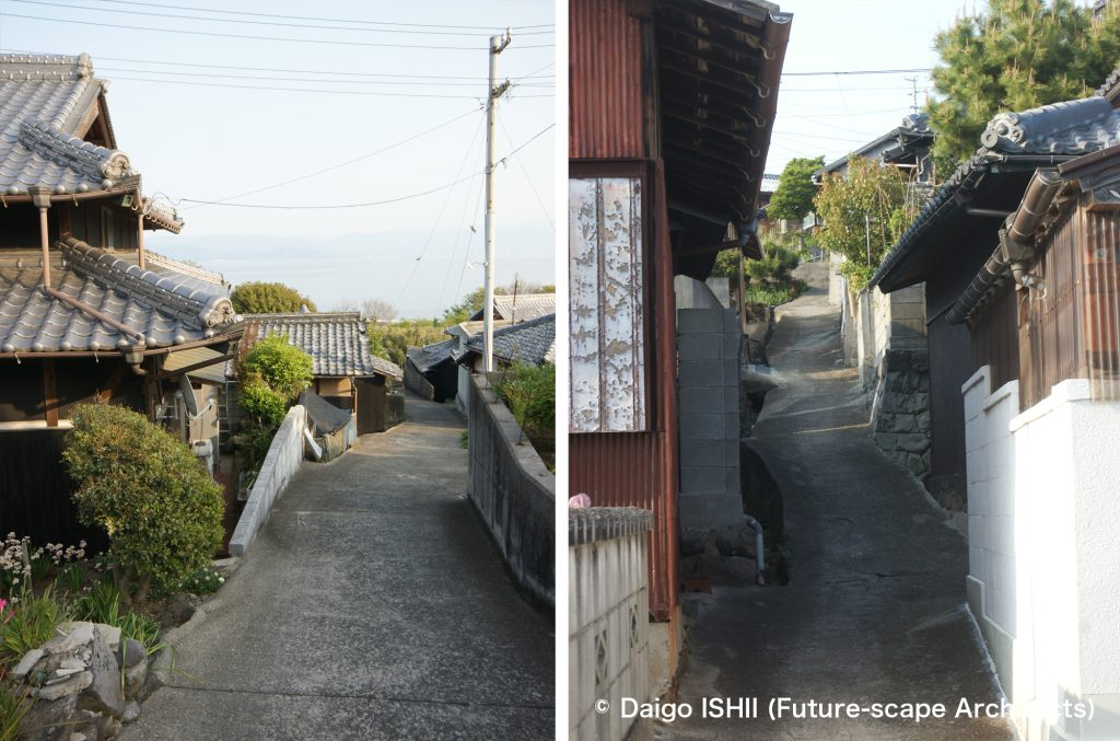
瀬戸内海に浮かぶ伊吹島は、本土側の観音寺から1日5便の船で25分。面積1平方キロの1島1集落の孤島ですが、漁業の恵みで、最盛期の昭和30年代には4000人住んでいた、おそらく瀬戸内海の島々では、もっとも規模の大きな集落。そして、板張りや漆喰の壁に瓦屋根という瀬戸内らしい家並みの間を通る、路地のネットワークの規模でも、瀬戸内海一二を争います。その路地は、さらに、港から島の中心まで標高差40m、集落のいちばん上まで80mと、路地が高低差の中に展開されるから、向かうところ敵なし。
Ibukijima Island is located in the Seto Inland Sea by a 25-minute boat ride from Kannonji city on the mainland. It is a solitary island with an area of 1 km2. However, it is the largest island village in the Seto Inland Sea, with 4,000 people living in the 1950s due to the blessings of the fishing industry. A network of narrow alleys is between houses with traditional wooden and plastered walls and tiled roofs. The scale of the network is also biggest in the Seto Inland Sea. Furthermore, the alleys spread out with an altitude difference, 40m high at the center and 80m high at the top of the village from the port, so there is no rival in the Seto Inland Sea.
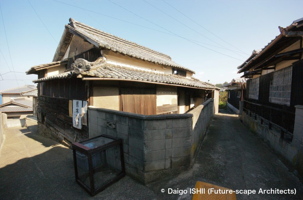
See an alley passing through an area lined with historical houses of a fishermen boss.
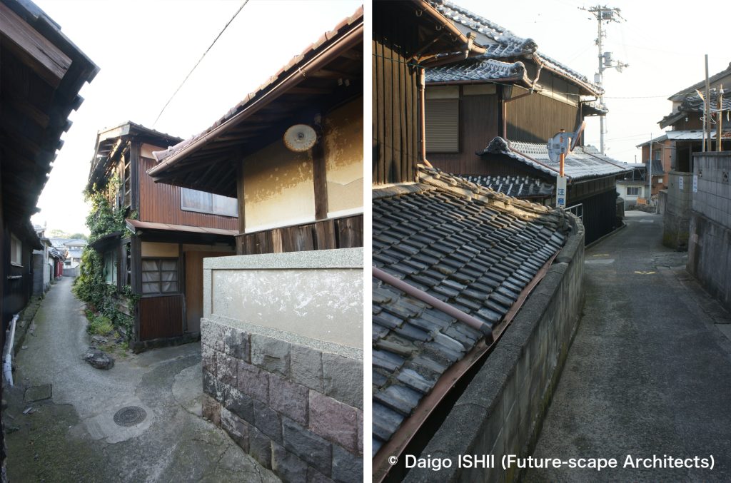
路地の中心は、明治時代の古図に載るものが、今も引き継がれたもの。明治初め1000人の人口が、最大4000人に増えるに連れて、周りの急斜面に、家とともに拡大して行きました。海賊の侵入を阻むため、見通しを悪くつくったとも言われ、とにかく、迷路の連続。何度も通い、島の路地をほとんど歩き尽くしても、いつもこんがらがります。
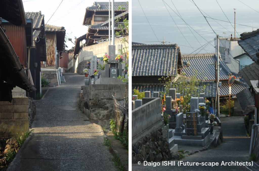
元々は石混じりの土の路面が、コンクリート平板に変わったのが昭和30年代前半。現場製作で、その場その場のカーブや複雑な境界線に合わせて、不定形のピースをつくったのだから、かなりの労作。歩きやすくなったものの、それまで同様、港からの荷物は負い子で背負い、徒歩で運ぶ時代が続きました。
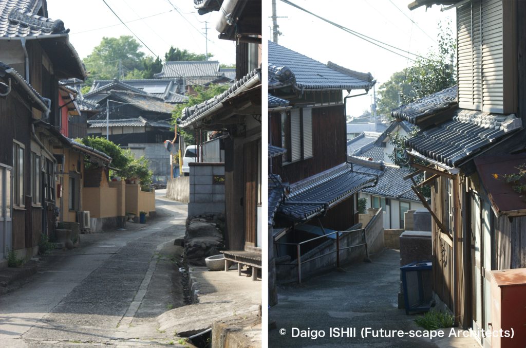
その路地の姿が大きく変わり、徒歩で運ぶ労苦から解放されたのが、昭和30年代半ば。オート三輪の普及により、両側の私有地を浸食して、路地の幅員を少し広げ、路面をコンクリートで固めました。しかし、その後、世の中は、オート三輪から自動車に移り変わりましたが、伊吹島の集落で、再び、道が拡幅されることはありませんでした。集落から外れた、浜際のいりこ工場地区を結ぶ外周道路を除けば、集落内の路地は、昭和30年代のまま。唯一の例外に見える、港から集落の中央の神社を経由して、上のお堂まで続く広い道は、自動車に配慮したのではなく、秋のちょうさ祭りでころがす山車から決まった幅。
同じ僻地でも、本土の山村の多くが、モータリゼーションに呑み込まれ、存続のために、車対応の道路を整備したのに対して、瀬戸内には、車の時代の前で時が止まった、ヒューマンスケールの路地集落が多く残ります。集落のコンパクトな大きさと、集落の港と本土をつなぐ公共交通であるフェリーの存続が、高齢者や子供の交通弱者に優しく、車に頼らずとも生活可能な環境を維持し、それが、路地や、路地を介した近所付き合いを残したというのが、伊吹島の路地の教え。
The actual alleys in the central part appeared in the old map in the 19th century. As the population of 1,000 in the 1860s increased to 4,000 at the maximum, the alleys expanded along with the houses on the surrounding steep slopes. It is said that the poor visibility was because of preventing pirates from entering. So the network of alleys is a maze. Even after knowing most alleys through many stays, I'm always confused to reach my destination.
Originally, the alley surface was soil mixed with stones. In the early 1950s, it changed into precast concrete plates. It was produced into irregular-shaped pieces on-site to match the curves and complicated borders on each spot. It became easier for islanders to walk, but they still had to carry luggage on the back and on foot from the port.
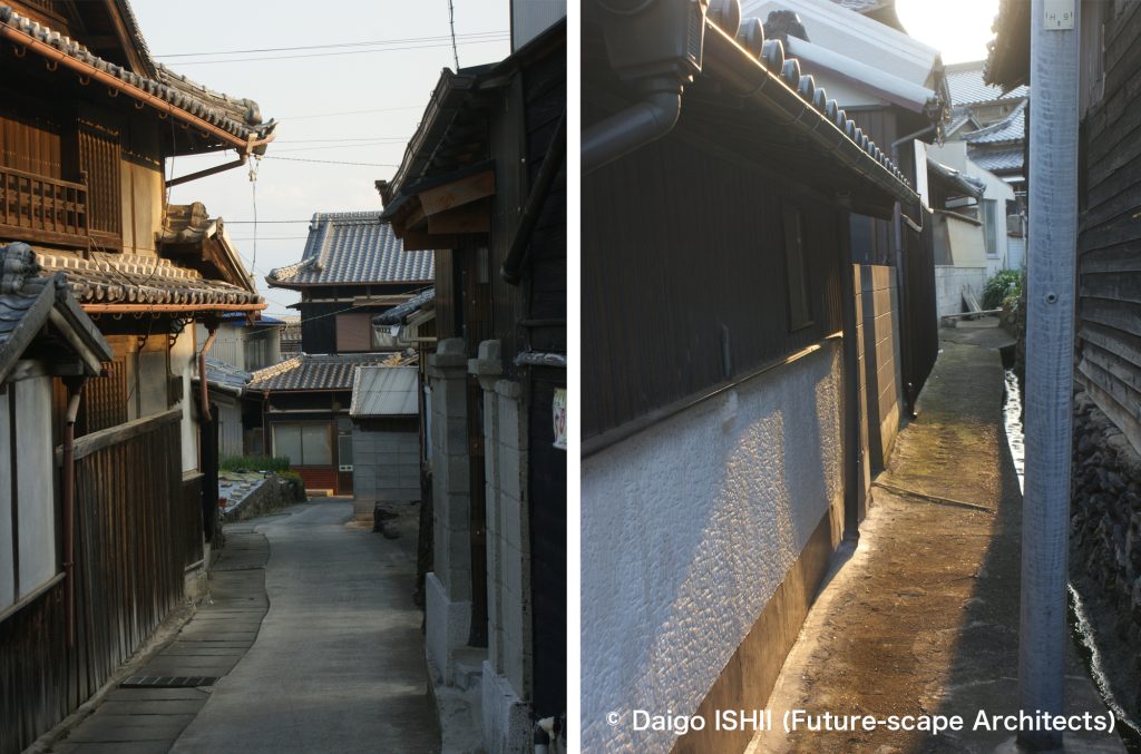
In the mid-1950s, spread of auto three-wheelers changed the alleys dramatically. Islanders provided a part of the private properties on both sides of the alleys to widen the width, and the surface was hardened with concrete. That freed islanders from toiling. However, the change stopped at that time. The world shifted from auto three-wheelers to automobiles, but inside the Ibukijima island village, the width of the alleys didn't expanded again for an automobile. Except the outer road that connects the dried Japanese anchovy factories area along the shore, the alleys in the village remain as they were in the 1960s. The only exception is the wide street that runs from the port to the temple via the shrine in the center of the village. It was no consideration for an automobile but the floats in the traditional festival "Chosa."
Many of the remote mountain villages on the mainland were swallowed up by motorization and built roads for cars due to their survival. Meanwhile, in Seto Inland Sea, many villages with human-scale alleys remain as if time had stopped before the age of cars. The compact settlement and the continuance of a public ferry that connects the port of the village with the mainland maintain an environment which are friendly to weak people in transportation like the elderly and children, and are possible for residents to manage to live without relying on cars, so has continued alleys and neighborhood relationships through the alleys. That was what I learned in the alleys of Ibukijima island.
伊吹島の全景 / Complete view of Ibukijima Island
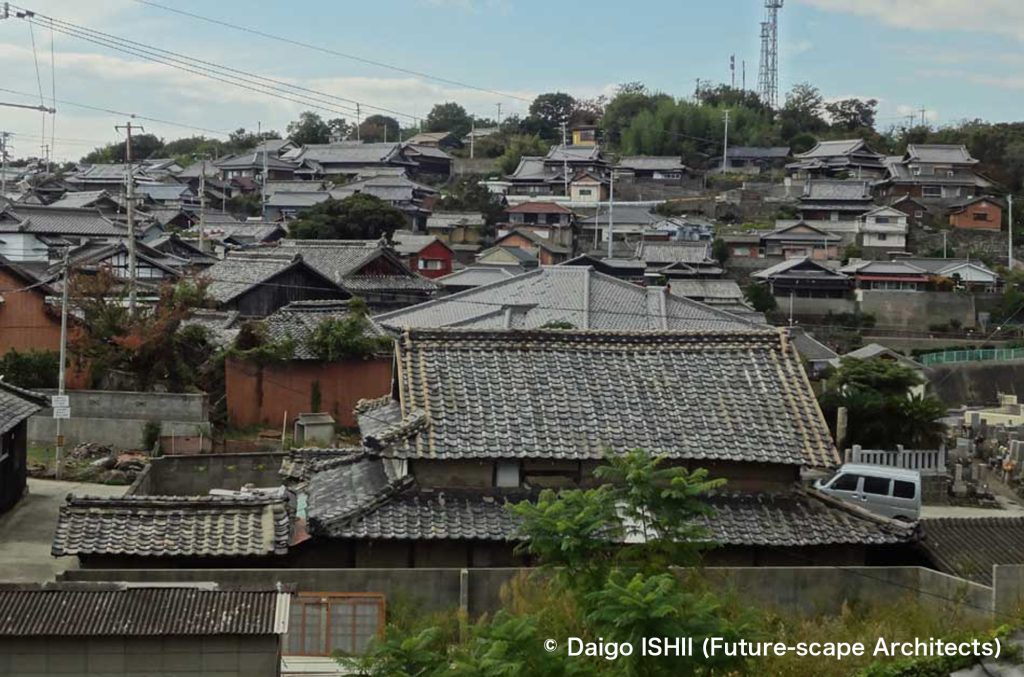
See the village from halfway up the island. The house visible at the top is at a height of 80 meters from the port.
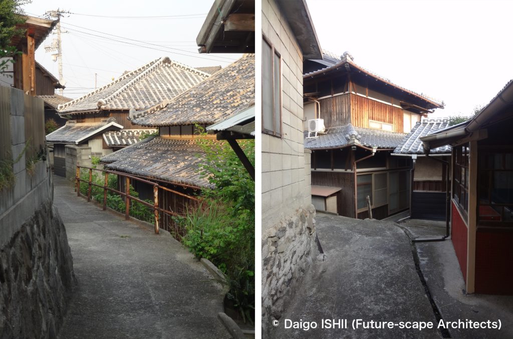
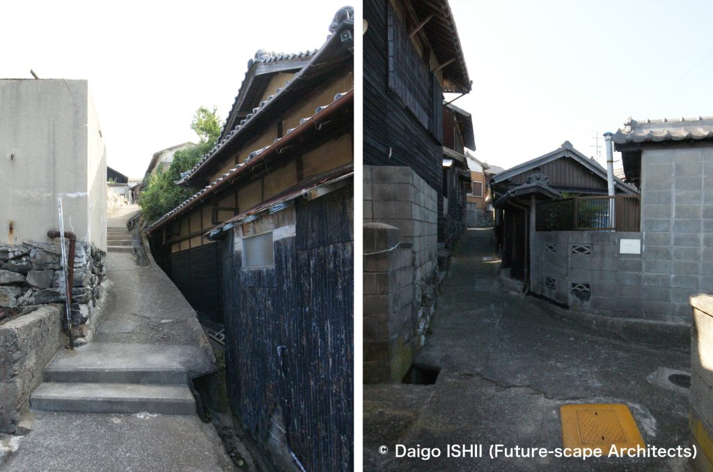
路地 / Alleys
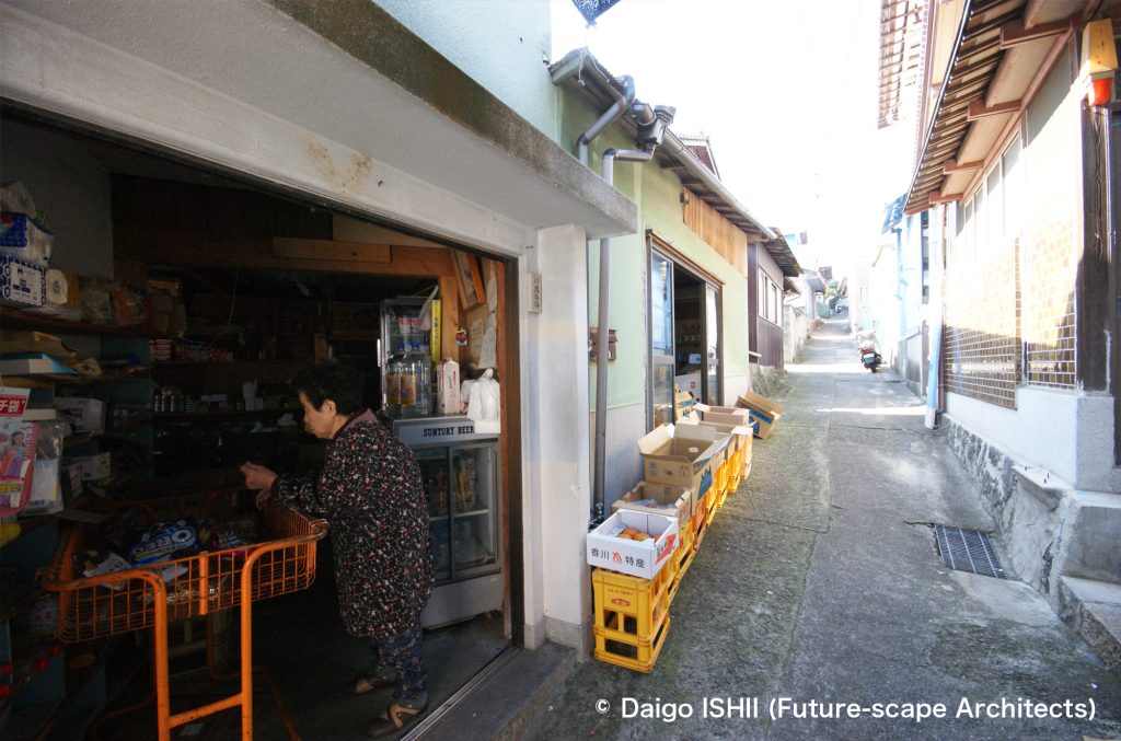
A store that recently closed. Outdoor stands were set up in the alley, and in the summer, a movable eave was hung on the alley, and the open conversation space inside the store and the alley were integrated.
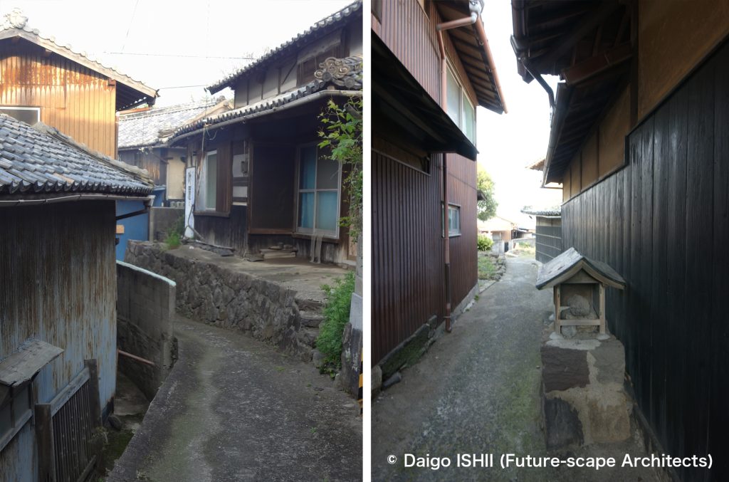
A shrine has been built in the alley in the photo on the right, enshrining the deity of the land called "Ojinushisama."
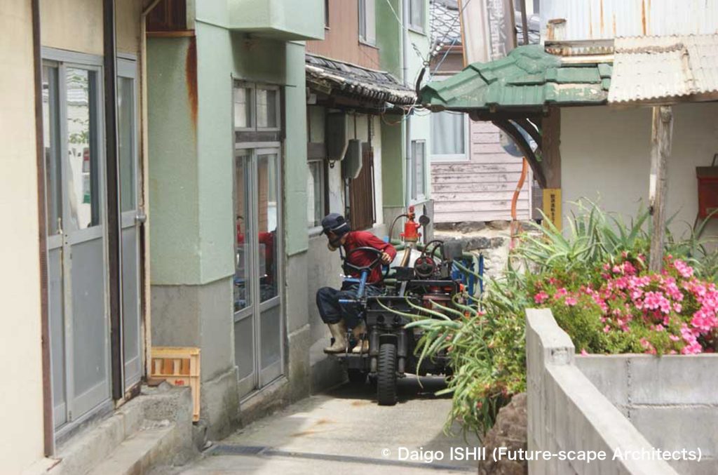
Since there are many alleys where cars cannot pass, auto three-wheeler garbage trucks, fire trucks, and work vehicles are still in use.
トイレの家 / House of Toilet
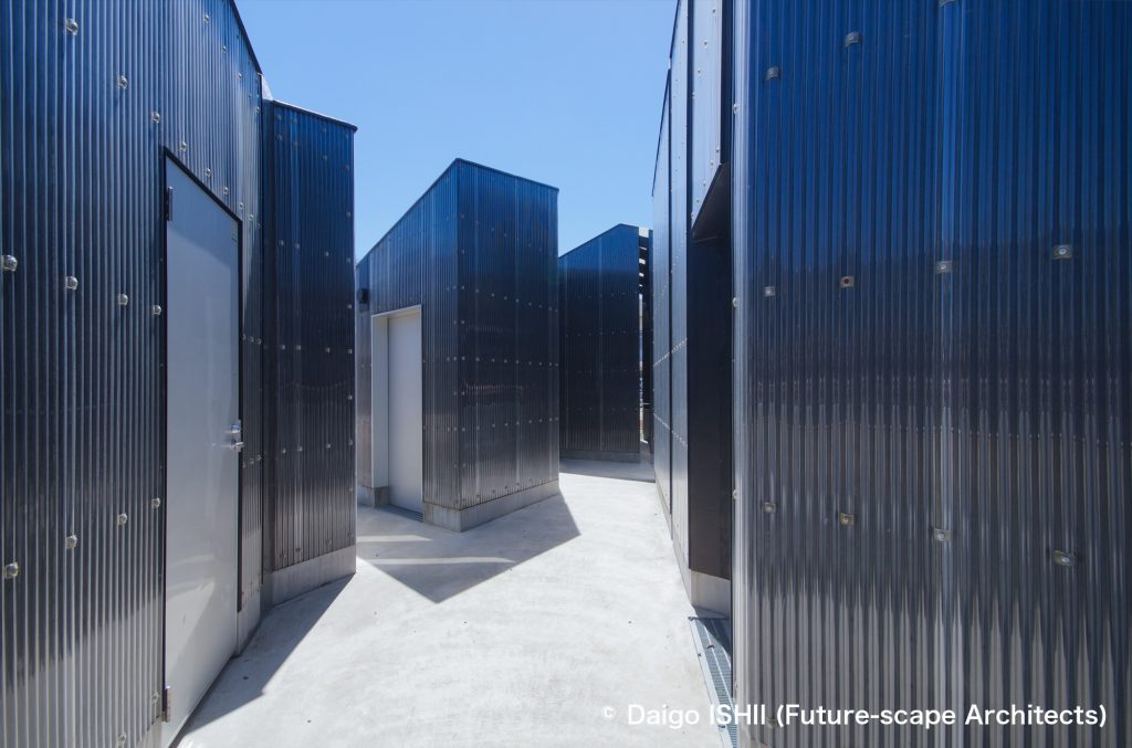
”House of Toilet", which I designed in Ibukijima Island in Art Setoutchi Triennial, has an alley inside the building with the motif of the alleys like a maze in the island.
https://goo.gl/maps/KSdyokfCBsH7YY6q8
ご感想はこちらへ / Click here for your impressions
参考文献 / reference
伊吹島民俗資料館
写真の無断使用、転用はご遠慮下さい。/ Please do not use or upload our photos without permission.