社会階層と住居表示が結び付いているとしたら、どれほどたいへんなことだろう。それがボゴタ。
How difficult it would be to associate social class with addressing system. That is Bogotá.
Coordinates : Carrera 17th and Calle 33rd South
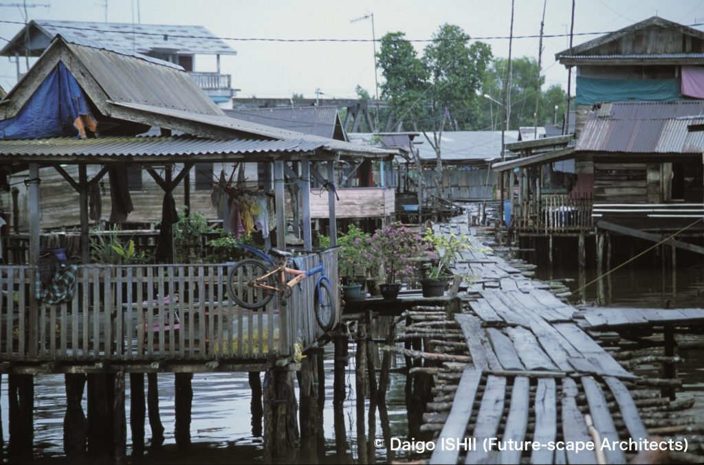
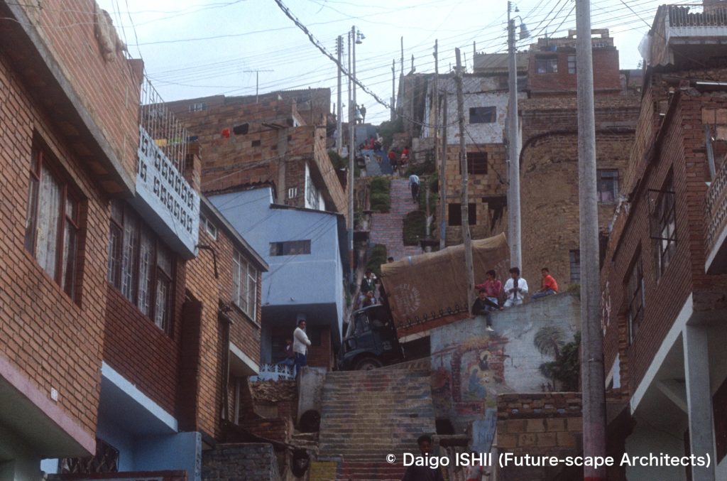
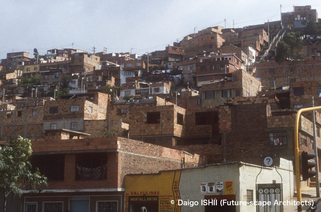
スール(南地区) : 急斜面に家が重なり合い、急階段が平地と丘の上を結ぶ。
Sur (South District) : See the townscape of Sur. Houses overlap on steep slopes, and steep stairs connect plains and the top of the hill.
https://goo.gl/maps/5EAtREmAFWUbVTkB7
南北30キロ、東西20キロのボゴタの街は、
南北に走る街路:カレラ
東西に走る街路:カージェ
により、格子状に区切られています。
通りは番号制で、セントロ(旧市街)のカレラ1番、カージェ1番が出発点。
住んでいた当時は、カージェは、セントロ(旧市街)の南北に伸び、北側に広がるノルテ(北地区)方向には170番まで、セントロの南側に広がるスール(南地区)には90番まで数えました。スール(南地区)方向のカージェには番号の末尾にスール(南)を加えて、カージェ50番スールのように表示し、番号だけのノルテ(北地区)方向のカージェと区別。
東西に伸びるカレラはセントロ(旧市街)から西に伸びて、130番まで数えました。街の東側は山のため、市街はほとんどありませんが、ほんの一部あった斜面の新しい市街地だけ、カレラの番号の末尾にエステ(東)を加えて、カレラ3番エステのように表示していました。
街の拡大で、ねじれた部分も出現しましたが、無理矢理、数字のマトリクスに収めています。
「カレラ7番通りのカージェ5番交差点から数えて12区画目」の家なら、住所は「カレラ7番、5ー12」。座標そのまま。そして、この座標化された住居表示が、社会構造を映し出すマトリクスになっています。
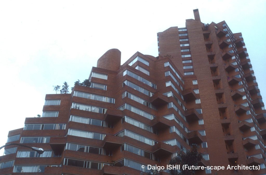
ノルテ(北地区)の、カージェ90番とカレラ11番の交差するあたりが、もっとも裕福なチコ地区で、そこを頂点に、番号が南北、または西に遠ざかるにつれて、等高線のように、社会階層が落ちて行きます。元々の中心であったセントロ(旧市街)は衰退し、さらにその先にある、スール(南地区)は落ち込みが大きくなります。住所の座標点を聞けば、行ったことのない場所でも、頂点のチコ地区との番号差で、社会階層から所得水準までおおよそ推定できます。だから、自分の住所を言うことは、所属階層をあらわにすること。それをエストラートの制度が強調します。街を6階層に分け、最下層と最上層の電気水道料金に10倍以上の差を付けていました。
友人の友人の話ですが、スールに住む商店主は、お金を貯めて、アッパークラスの住むノルテに小さな部屋を借りました。娘をそこから学校に通わせ、見事ノルテの青年と結婚したところで、アパートを解約し、スールに戻ったそうです。
植民地時代、スペインのインディアス法に基づいてつくられた格子街区。600年後も、インディアス法が確立した階層社会の呪縛が、ボゴタの街に影を落としています。
The city of Bogotá is 30 km north-south and 20 km east-west and is divided into grids by
Carrera : streets running north-south
Calle : streets running east-west
The city numbered the streets. Calle started from Calle 1st and Carrera from Carrera 1st in Centro (downtown).
When I lived there, Calle extended to 170th in Norte (North), 90th south in Sur (South). "South" is added to the end of the Calle number in Sur as Calle 50th Sur to distinguish from Calle in Norte
Meanwhile, Carrera extended to 130th in the west . The area located on the east side of the city is mountainous, so there is almost no urban area. Only a small part of the new urban area on the slope was displayed like Carrera No. 3 Este (East) by adding Este at the end of the Carrera number.
Due to the expansion of the city, twisted parts had appeared, but the city forced them to fit in the matrix of numbers.
If a house is located on the 12th lot on Carrera 7th, counting from the intersection with Calle 5th street, the address is 'Carrera 7th, 5-12'. It was just the coordinates. This coordinated addressing system became a matrix that reflected the social structure.
The top of the coordinates was Chico districts of Norte, where Calle 90th and Carrera 11th intersect. Starting from the top as the reference point, social class descended like contour lines as the numbers moved north-south or west. The original center of the city, Centro (Downtown), has declined, and, in Sur (South District) beyond Centro, the depression was outstanding. If you asked the coordinate points in the address of someone, you could roughly estimate from his/her social class to the income level, even in places you had never been, based on the number difference with the reference point. So, to say your address is to reveal your social class. Estrato's system emphasizes it. The city was divided into 6 layers called Estrato, and the difference in electricity and water charges between the lowest layer and the highest layer was more than 10 times.
A friend of my friend, who was a shopkeeper in Sur, saved his money and rented a small room in Norte, where the upper class lived. After having sent her daughter to school from there and having married a young man from Norte, he canceled his apartment and returned to Sur.
The Spanish Law of the Indies established this grid block system during the colonial period. Six hundred years later, the hierarchies that the Laws of the Indies structured still cast a shadow over the city of Bogota.
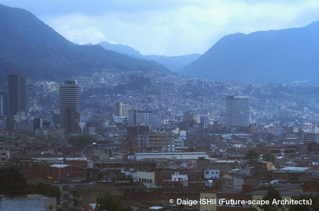
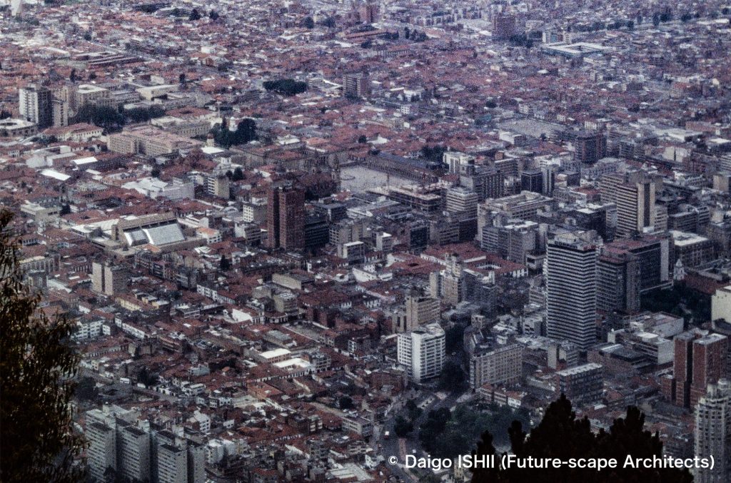
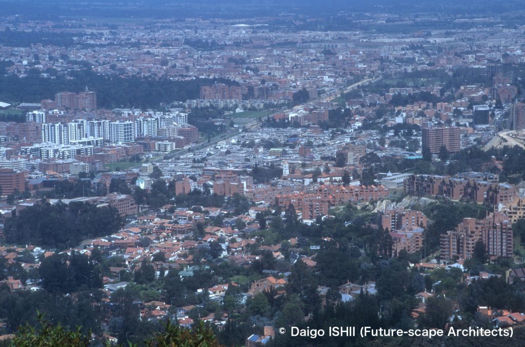
See the townscape of Sur (South District) that houses overlap on steep slopes beyond the skyscrapers of the Centro (Downtown). Carrera 1st and Calle 1st start from the southeastern end of Centro.
https://goo.gl/maps/YH5PXwi3WKc5ig6Y8
スール(南地区) / Sur (South District)
Coordinates : Carrera 15th - 17th and Calle 32nd South - 33rd b South
スール(南地区) : 急斜面に家が重なり合う。
Sur (South District) : See the townscape of Sur. Houses overlap on steep slope.
https://goo.gl/maps/5EAtREmAFWUbVTkB7
Coordinates : Carrera 17th and Calle 33rd b South
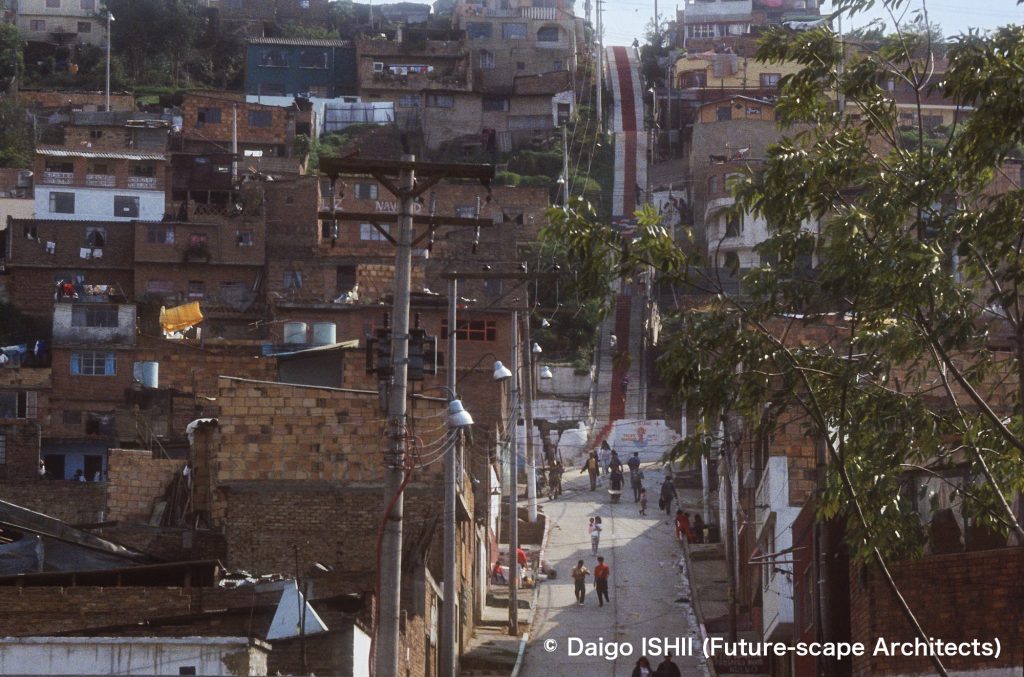
スール(南地区) : 急斜面に家が重なり合い、急階段が大通りと丘の上を一直線に結ぶ。
Sur (South District) : See the townscape of Sur. Houses overlap on steep slopes, and steep stairs connect the main street and the top of the hill in a straight line.
https://goo.gl/maps/tazqWyGFKtgqvVBU8
https://goo.gl/maps/5EAtREmAFWUbVTkB7
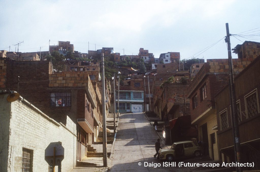
Coordinates : Carrera 17th and Calle 35th South
スール(南地区) : Google Mapsで見つけた2018年と2020年のストリートビューと、1990年代に撮影した写真を比べると、2018年の街並は、1990年代とそれほど変わらないが、2020年の街並は、煉瓦の外壁の上に、白い塗装を施した家が多くなる。2年間での変わり様は、経済発展の現われだろうか。
Sur (South District) : Compared with the street views of 2018 and 2020 on Google Maps with photos taken in the 1990s, the townscape in 2018 was not much different from the 1990s, but, in the townscape in 2020, the exterior wall of many houses was painted with white paint on the previous exposed bricks. The change during 2 years would be a manifestation of economic development in Colombia ?
https://goo.gl/maps/h6S5SvTpzaw1PU8c9 (Street view in 2018.11)
https://goo.gl/maps/Cb3ywVKxHykzKSbF9 (Street view in 2020.03)
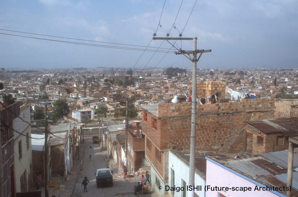
Coordinates : Carrera 17th and Calle 33rd b South
スール(南地区) : 丘から見下ろした街並。右中央の住宅を見ると、隣家に面して見えにくい部分の煉瓦は、大きな下地用の煉瓦を使い、道路に面した部分は、サイズの小さな仕上用の煉瓦を使っている。
Sur (South District) : Overlook the townscape from the hill. In the house at the right-center on the photo, the bricks facing the neighboring house that are difficult to see use large base bricks, meanwhile the part facing the road uses small finishing bricks.
https://goo.gl/maps/5EAtREmAFWUbVTkB7
セントロ(旧市街) / Centro (Downtown)
Coordinates : Carrera 1st - 10th and Calle 1st - 12th
セントロ(旧市街) : 中央の四角い広場が、セントロ(旧市街)の歴史的な中心であるボリーバル広場。そこを基準に、植民地時代、インディアス法に基づいて、格子街区が設けられた。このエリアは、碁盤目状にきれいに街区がつくられている。
Centro (Downtown) : The square in the center of photo is Plaza Bolivar, the historic center of Centro. Starting from the Plaza, grid blocks were set up under the Spanish Laws of the Indies during the colonial period. This area is neatly laid out in a grid pattern.
https://goo.gl/maps/pBphUjbWq7Y7NB9H7
Coordinates : Carrera 7th - 8th and Calle 10th - 11th
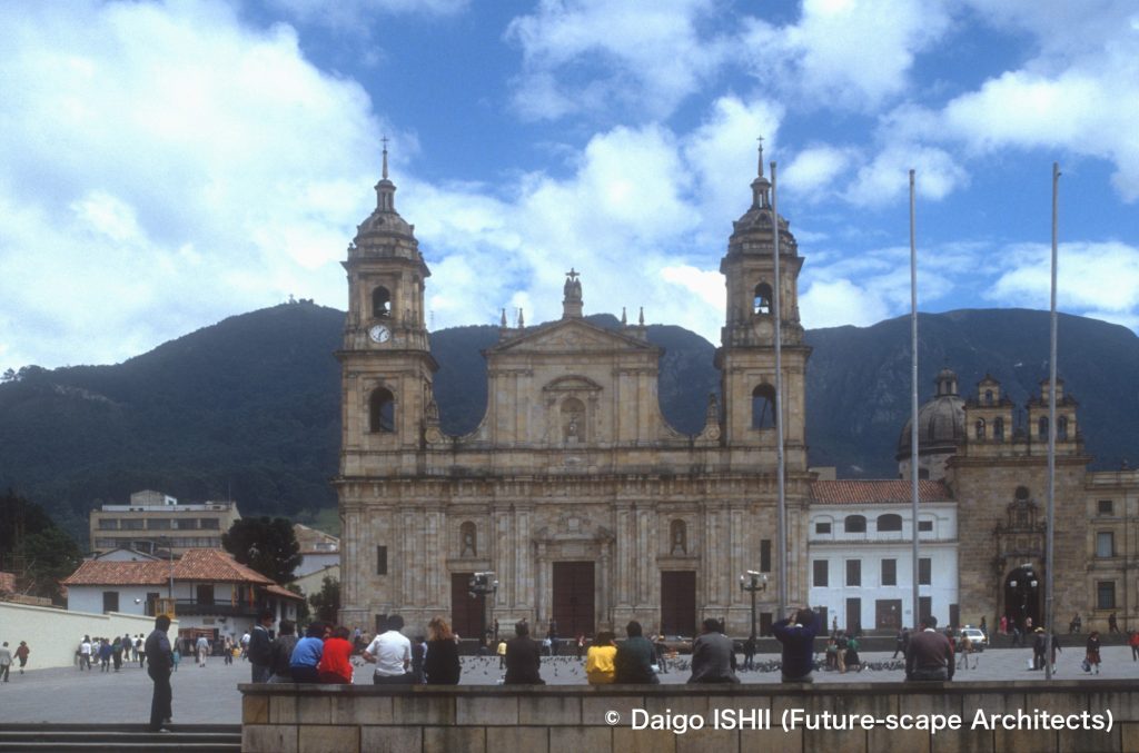
セントロ(旧市街) : セントロの中心、ボリーバル広場と、広場に面したカテドラル(首座大司教聖堂)。教会は19世紀初めの建設だが、1539年に最初の教会が建設された。
Centro (Downtown) : See Plaza Bolivar and the Catedral Primada de Colombia facing the plaza, in the center of Centro. The cathedral was constructed at the beginning of 19the century on the site where the first cathedral had been constructed in 1539.
https://goo.gl/maps/j8jPvJTMwpbQBG1r8
Coordinates : Carrera 5thb and Calle 11th
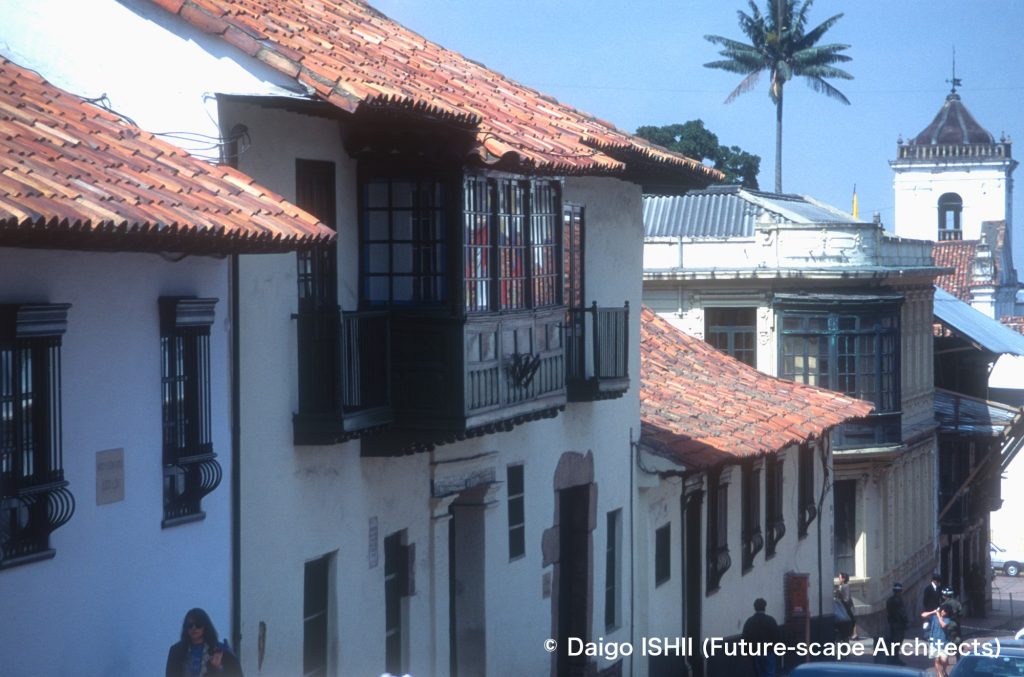
セントロ(旧市街) : セントロの歴史地区。
Centro (Downtown) : See the historic district in Centro.
https://goo.gl/maps/8erMT8Ac6AjmrFf4A
Coordinates : Carrera 4th - 5th-b and Calle 10th
セントロ(旧市街) : セントロの歴史地区。
Centro (Downtown) : See the historic district in Centro.
https://goo.gl/maps/ry4APM3YWjLAEPqTA
Coordinates : Carrera 10th and Calle 11th - 15th
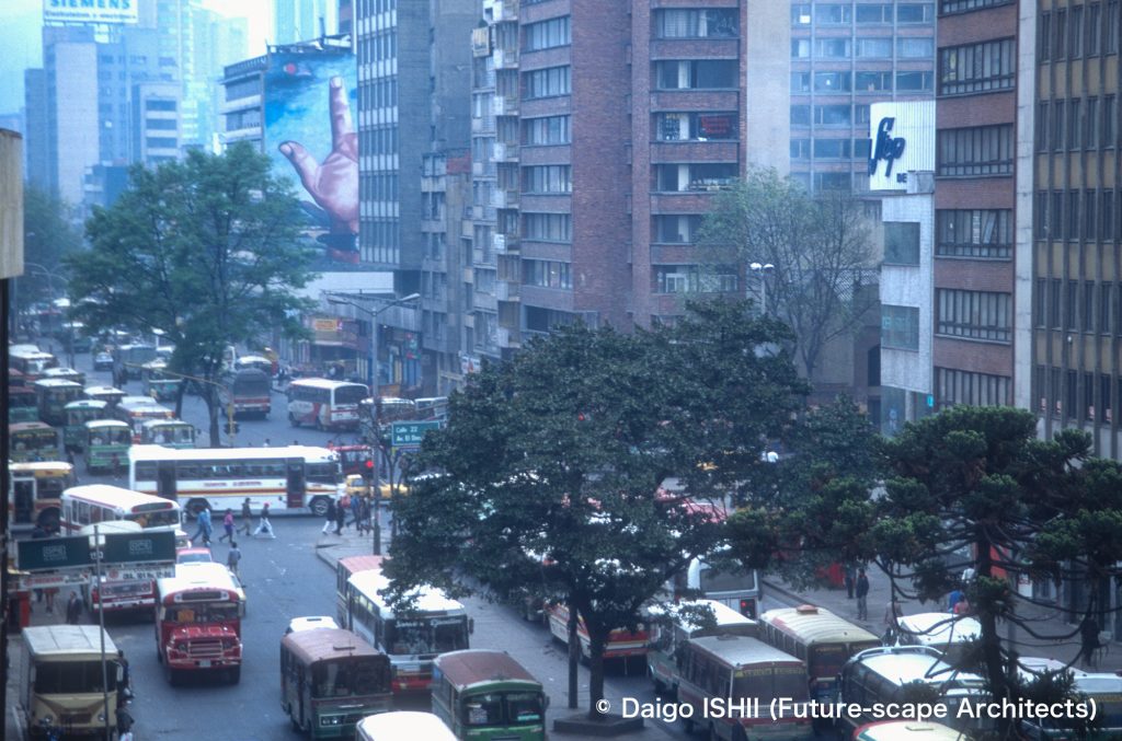
セントロ(旧市街) : 中心を貫く交通幹線、カレラ10番通りの街並み。
Centro (Downtown) : See the streetscape on Carrera 10th street that was the traffic tank running through Centro.
https://goo.gl/maps/F6r2ApYNStt1Zrbc9
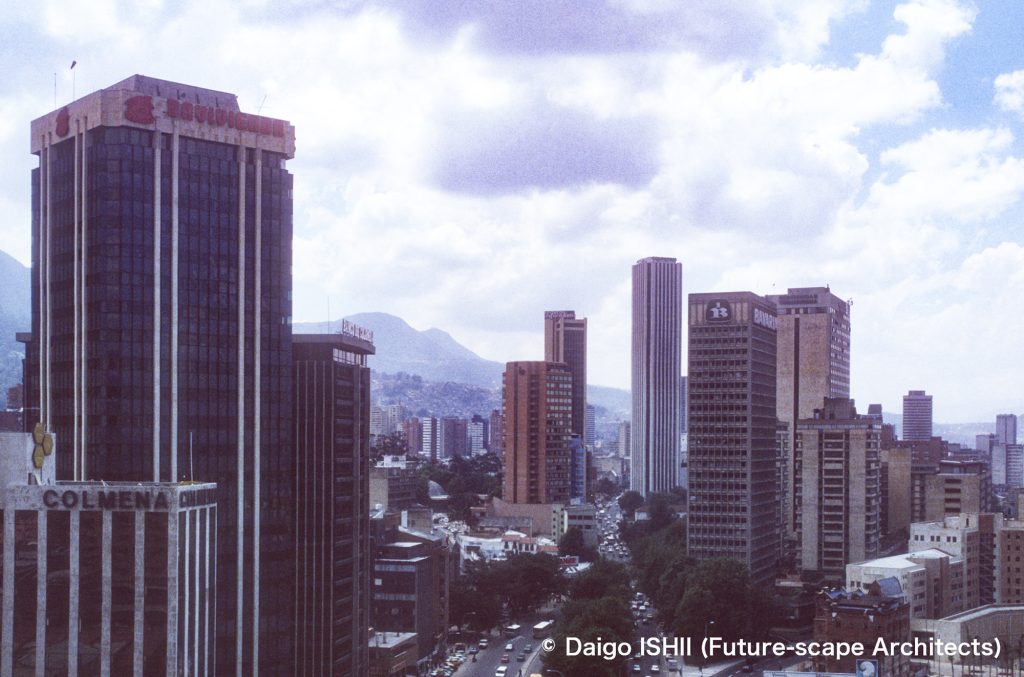
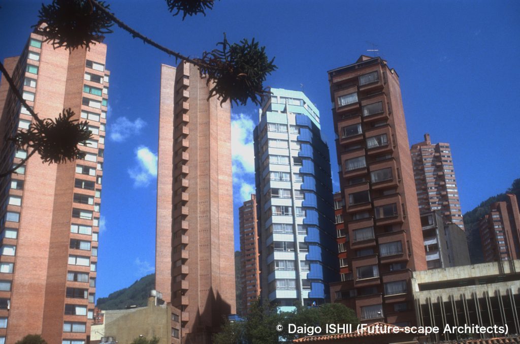
Coordinates : Carrera 7th and Calle 24th - 32nd
セントロ(旧市街) : 北端に広がるオフィス街から、セントロの中心方向を見る。中央の大通りは、ボゴタの幹線であるCarrera7番通り。中央の高いビルが、1979年にオープンし、2016年までコロンビアでいちばん高かった高層ビル、トーレ・コルパトリア。50階建てで高さ196m。
Centro (Downtown) : See toward the center of Centro from the business district that extends to the north end of Centro. The central boulevard is Carrera 7th street as Bogota's main street. The tall building in the center is the Torre Colpatria, which opened in 1979 and was the tallest skyscraper in Colombia until 2016. It has 50 floors and a height of 196m.
https://goo.gl/maps/cBKVSrGTrycj7C83A
テサキージョ / Tesaquillo
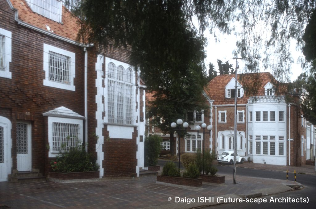
Coordinates : Carrera 16th and Calle 37th
セントロとノルテの中間 : 20世紀初めに開発された、当時の郊外住宅地のテサキージョ。セントロとノルテの間に位置する。この辺りから、北に広がるチャピネーロまでの間には、ボゴタの中心部から移って来たアッパークラスの市民の住む、当時のヴィクトリアン様式の住宅が広範囲に残っている。チャピネーロは、住宅街の間に、歴史的建築を利用したお洒落なレストランや店が点在している。
Halfway between Centro and Norte : See Tesaquillo, then a suburban residential district developed in the early 20th century. It is located between Centro and Norte. From there to the north where Chapinero is located, the Victorian houses of the time, which were inhabited by upper-class citizens who had moved from the center of Bogotá, extensively remains. Chapinero is dotted with stylish restaurants and shops that use historical architecture in residential areas.
https://goo.gl/maps/PYmK9oiSLvYWesHn7
https://goo.gl/maps/aU49jY6R87CfhDRNA
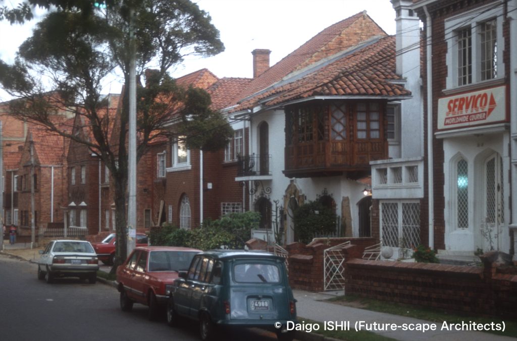
Coordinates : Carrera 17th and Calle 37th
セントロとノルテの中間 : 20世紀初めに開発された、当時の郊外住宅地のテサキージョ。
Halfway between Centro and Norte : See Tesaquillo, then a suburban residential district developed in the early 20th century.
https://goo.gl/maps/PYmK9oiSLvYWesHn7
https://goo.gl/maps/MmmYqqCa6GPLT4pE8
ノルテ(北地区) / Norte (North District)
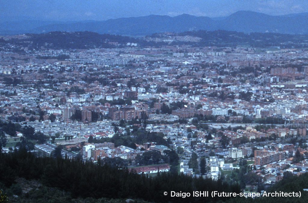
Coordinates : Carrera 1st - 7th and Calle 108th - 116th
ノルテ(北地区) : 森の下あたりが、高級住宅街のチコ。
Norte (North District) : See residential areas in Chico under the forest.
https://goo.gl/maps/oYM1p4dFvcUdLPUp8
Coordinates : Carrera 1st - 7th and Calle 108th - 116th
ノルテ(北地区) : チコに隣接するノルテの住宅街を丘から見下ろす。ボゴタでも緑豊かな住宅街の一つ、ウサケンが足元に広がる。
Norte (North District) : Overlook residential areas in Norte, adjacent to Chico, from a hill. Usaquen, one of the greenest residential areas in Bogota, is the foot of the hill.
https://goo.gl/maps/W48JeMko2LvGW3Ui6
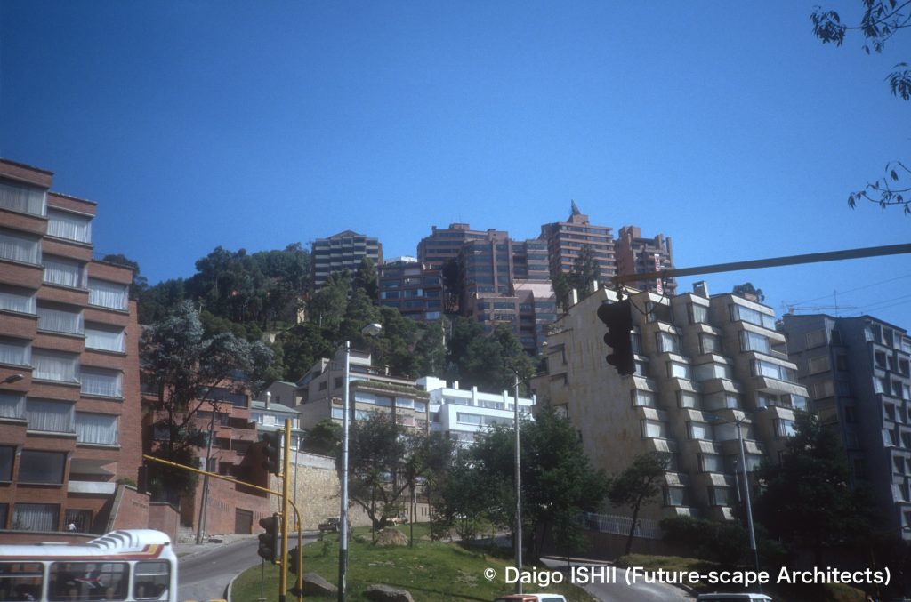
Coordinates : Carrera 7th and Calle 92nd
ノルテ(北地区) : ノルテの高級住宅地。ボゴタの大幹線、カレラ7番の交差点から、山側の斜面の高級コンドミニアムを見上げる。撮影地点の背中側が、いちばんの高級住宅街のチコ地区。
Norte (North District) : Look up luxury condominiums on the slope of the mountain side from the intersection of Carrera 7th as the thoroughfare of Bogotá in the upper class district of Norte. The back side of the shooting point is the Chico district, the highest-class residential area.
https://goo.gl/maps/cMcCXcUtyxCDAAWu6
西部地区 / Western District
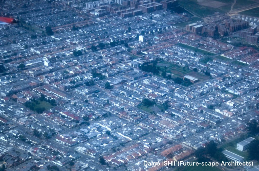
Coordinates : Carrera 74th - 82nd and Calle 24th - 25th
西部地区 : 中間層の戸建て住宅地。
Western District : See middle class detached residential area.
https://goo.gl/maps/oY12vPUwb8JtGPBK9
Coordinates : Carrera 69th and Calle 24th
西部地区 : 中間層のための集合住宅が大規模に開発されたエリア。
Western District : See an area where large-scale housing complexes for the middle class have been developed.
https://goo.gl/maps/jP8HGB1C2FLEKRXW9
ご感想はこちらへ / Click here for your impressions
参考文献 / reference
Wikipedia
写真の無断使用、転用はご遠慮下さい。/ Please do not use or upload our photos without permission.